Boundary County Views from Pace Home:
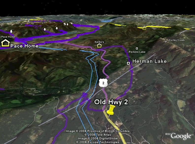
Organized in relation to the Zita Pace home located at 7087 Funkhouser ST, this is the first street on the left as you enter Bonners Ferry, Idaho from the South.
So, turn left at the Bear Creek Lodge, last house on the right.
Our home is also the only home that looks down on the first tee and clubhouse of Mirror Lake Golf Course. Here is the first view of Bonners Ferry and our home from the south looking north.
In this picture, Notice: first road on the left as you enter town, after Mirror Lake Golf and old hwy.
1 Central Boundary County Views
Pictures Zita Pace Home
2 South and East Boundary County Views
Notice: first road on the left as you enter town, after Mirror Lake and old hwy.
3 North Central Boundary County Views
10 Pictures of Hazel Pace Cabin
4 West and Northwest Boundary County Views
5 East and North East
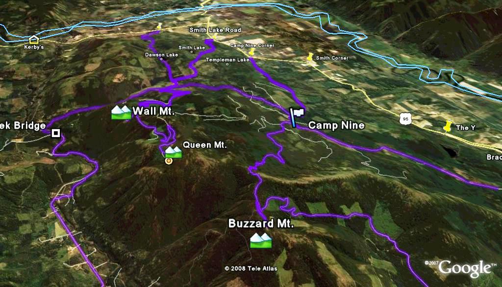
6 Camp Nine Area
7 South Central
01 Continental Mountain
02 Cutoff Peak
03 Parker Peak
04 Fisher Peak
05 Smith Peak
06 Lookout Peak
07 Myrtle Peak
08 Kent Peak
09 Eddy Peak
10 Goblin Knob
11 Harrison Peak
12 Roman Nose
13 Mount Roothaan
14 Chimney Rock
15 Hunt Peak
16 Jeru Park
17 Schweitzer
18 Twin Peaks
19 Silver Dollar Peak
9 East Kootenai
10 Golf
Southeast BC Courses
Creston - West Kootenay
Cranbrook – East Kootenay
Other Southeast BC Courses
North Idaho Courses
Bonners Ferry - Mirror Lake
Sandpoint – Jack Nicklaus’ Idaho Club


